National Highway Situational Radar • Real-Time Datex II Protocol

UK Road Closures Today & Live Traffic Incident Radar

Real-time operational monitoring across the 4,500-mile UK Strategic Road Network. Verify active carriageway closures, emergency lane restrictions, predicted clearance times, and official Department for Transport (DfT STATS19) accident safety baselines.

HIGHWAYS VMS GANTRY SIGNAL LIVE RADAR BROADCAST
M25 2 LANES CLOSED
J15 to J16 (M4 / M40) MULTI-VEHICLE COLLISION DELAYS 45 MIN
Inspect Hub →
A38 LANE 1 BLOCKED
LICHFIELD (A5148 INTERCHANGE) RECOVERY IN ATTENDANCE DELAYS 20 MIN
Inspect Hub →
M4 50 MPH LIMIT
PRINCE OF WALES BRIDGE (J22-J23) STRONG CROSSWINDS CAUTION ACTIVE
Inspect Hub →
A303 SLOW TRAFFIC
STONEHENGE SECTION (AMESBURY) BOTTLENECK MERGE DELAYS 25 MIN
Inspect Hub →

UK Strategic Road Network Situational Vector Radar

Interactive spatial monitoring of monitored corridors, junctions, and live Datex II incident hot-zones.

Motorway Spine Strategic A-Road Active Disruption
M25 M1 M4 M5 A38 A303 A30 A66 A14 A19 A46 A5 A3

UK Strategic Road Network Status Matrix

National Highways Real-Time Broadcast • Updated Every 15 Mins
Corridor Route Role Status Operational Summary Incidents Live Hub
A38 A38 Trunk Road Derbyshire, Staffordshire, West Midlands Lane Restriction

National Highways reports one lane closed southbound between A5148 Lichfield and B5026 due to recovery operations following an earlier multi-vehicle collision. Residual delay is estimated at 22 minutes.

2 Inspect
A303 A303 Trunk Road Hampshire, Wiltshire, Somerset Normal Flow

National Highways confirms normal traffic flow across the A303 corridor. Stonehenge bottleneck at Winterbourne Stoke is operating under typical seasonal volumes with no carriageway closures reported.

1 Inspect
A3 A3 Trunk Road Greater London, Surrey, Hampshire Normal Flow

Carriageways running clear in both directions. The Hindhead Tunnel is operating at full capacity under standard 70 mph dual carriageway regulations with zero lane closures.

0 Inspect
A19 A19 Trunk Road South Yorkshire, North Yorkshire, Teesside Lane 2 Closed Northbound near Billingham

Emergency carriageway pothole repair underway northbound between Wolviston Interchange and Billingham. Lane 2 is closed with 15 minutes delay on approach.

1 Inspect
A66 A66 Trans-Pennine Trunk Corridor Cumbria, County Durham, North Yorkshire Normal Flow

National Highways confirms clear carriageways across the Pennine pass. Wind speeds at Bowes and Stainmore summit are below safety threshold levels with no high-sided vehicle bans active.

0 Inspect
A14 A14 Strategic Freight Corridor Suffolk, Cambridgeshire, Northamptonshire Normal Flow

National Highways telemetry indicates free-flowing traffic across the central freight section between Huntingdon and Kettering. Variable speed limits set to national standard.

0 Inspect
A46 A46 Cross-Country Spine Somerset, Gloucestershire, Warwickshire Normal Flow

Traffic moving normally across all dual carriageway sections. Longbridge M40 junction and Newark roundabouts reporting no unexpected queues or closures.

0 Inspect
A5 A5 Historic Trunk Road London, Hertfordshire, Bedfordshire Normal Flow

National Highways reports open carriageways across the A5 network. Dunstable bypass and Hinckley low bridge corridors running with zero active road closures.

0 Inspect
M5 M5 Motorway West Midlands, Worcestershire, Gloucestershire Lane 1 of 4 Closed Southbound over Avonmouth Bridge

National Highways South West reports lane 1 closed southbound on the M5 Avonmouth Bridge (J18 to J19) due to an emergency expansion joint safety check. Delays currently stand at 18 minutes.

1 Inspect
M25 M25 London Orbital Motorway Surrey, Kent, Essex Dartford Crossing

High traffic density and variable speed management around the Dartford QEII bridge are causing 25-minute delays clockwise. Anti-clockwise tunnel bores are operating normally.

1 Inspect
M1 M1 Motorway Greater London, Hertfordshire, Bedfordshire Normal Flow

National Highways confirms clear motorway conditions along the M1 corridor. Smart motorway emergency refuge areas and variable signs operating normally with zero active carriageway closures.

0 Inspect
M4 M4 Motorway Greater London, Berkshire, Wiltshire Lane 1 & 2 Restricted

National Highways South West reports speed restrictions and outer lane closures on the M4 Prince of Wales Bridge (J22 to J23) due to gusting crosswinds exceeding 45 mph. Traffic moving with residual 20-minute delays; Severn Bridge M48 available as alternate route.

1 Inspect
A30 A30 Trunk Road Devon, Cornwall, Somerset Free-Flowing

National Highways confirms clear carriageway conditions across the critical A30 dualled sections between Carland Cross and Chiverton. Resurfacing works on the Bodmin section completed with zero daytime delays.

0 Inspect

Architecture of the UK Strategic Road Network (SRN)

The English Strategic Road Network encompasses approximately 4,500 miles (7,240 km) of motorways and major trunk A-roads managed by National Highways on behalf of the Department for Transport. While accounting for only 2% of England’s total road length by mileage, the SRN carries more than 34% of all motor vehicle traffic and over 68% of all heavy goods vehicle (HGV) freight movement.

Datex II XML Integration

Polls official Traffic England and Regional Operations Centre incident feeds every 15 minutes, identifying active carriageway closures and lane restrictions.

STATS19 Safety Baseline

Aggregates 5-year certified Department for Transport collision reports, providing verified casualty severity rates and historical blackspot intelligence.

Strategic Diversion Routes

Documents designated Emergency Diversion Routes (EDR symbols) mapped to guide commercial freight safely around closed motorway sections.

Maintaining fluid operational capacity across this infrastructure is essential to the national economy, supporting supply chains between deepwater container terminals like the Port of Felixstowe and logistics distribution hubs concentrated along the central English motorway spine (M1, M6, M5, M4, and M25 corridors).
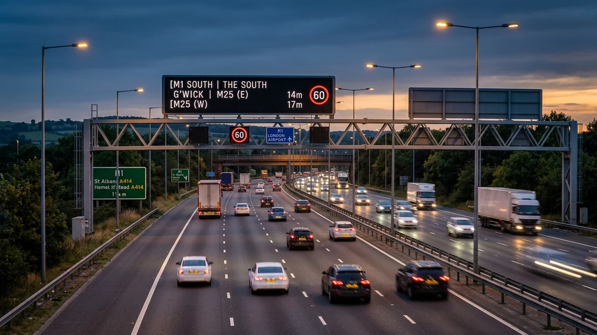
Aerial photographic view of a British motorway corridor at dusk with electronic gantry signage displaying active traffic advisory and lane status
AI Visual • Synthesised Highway Imagery
The UK Strategic Road Network (SRN) operates automated incident detection, variable speed limits, and electronic gantry signalling managed by National Highways Regional Operations Centres.

Real-Time Datex II Incident Ingestion & Emergency Monitoring

Operational incident data broadcast through this radar is ingested via the European Datex II XML standard protocol. National Highways Regional Operations Centres in Godstone, Wakefield, Birmingham, Nottingham, and South Mimms monitor thousands of inductive MIDAS loop sensors embedded in carriageway asphalt alongside pan-tilt-zoom CCTV cameras.

When an unplanned obstruction or vehicle collision occurs, our platform captures the exact junction-to-junction spatial bounds, affected directional carriageway (Northbound, Southbound, Clockwise, or Anti-Clockwise), and assigned incident severity tier within 15 minutes of official verification.

Department for Transport (DfT) STATS19 Safety Baselines

In addition to real-time incident broadcast, each monitored corridor incorporates 5-year aggregated casualty intelligence derived from the Department for Transport’s certified STATS19 national database. Under the Road Traffic Act 1988, all road collisions involving personal injury reported to police forces are recorded with standardized geographic coordinates, weather variables, and severity classifications.

Motorist Travel Intelligence & PAA Authority

Frequently Asked Highway & Travel Questions

Essential guidance compiled from National Highways operational protocols, Police collision reporting procedures, and the UK Highway Code.

How often is live UK road closure data updated?

Our incident radar synchronizes continuously with the official National Highways Datex II feed and Traffic England emergency logs every 15 minutes. High-impact emergency closures, overturned vehicles, and police rolling roadblocks are ingested and refreshed instantaneously.

What is the difference between a planned closure and an emergency closure?

Planned closures are pre-scheduled works (resurfacing, structural bridge repairs, overhead gantry maintenance) typically carried out overnight between 20:00 and 06:00 to minimize daytime traffic disruption. Emergency closures are immediate, unscheduled shutdowns ordered by National Highways or Police traffic officers in response to serious collisions, severe vehicle fires, structural damage, or severe weather conditions like flooding and high-elevation snowdrifts.

Where does the 5-year accident and casualty data come from?

Historical collision statistics, casualty breakdowns, and blackspot analyses are derived directly from the UK Department for Transport (DfT) certified STATS19 database. This dataset compiles official police accident investigation returns across all English, Scottish, and Welsh highway authorities under Open Government Licence v3.0.

How are official diversion routes determined when a motorway closes?

National Highways designs dedicated Emergency Diversion Routes (EDRs) for every strategic junction on the English motorway and trunk network. These routes are designated by standard geometric symbols (yellow symbols on black square backgrounds: diamonds, triangles, circles, and squares) signposted on local and regional A-roads to safely accommodate heavy freight traffic.

Who should I contact to report active debris or dangerous road hazards?

For active emergencies, stationary vehicles stranded in live running lanes without a hard shoulder, or major hazards on the motorway network, call 999 immediately. For general road debris or non-emergency highway enquiries in England, contact National Highways directly on 0300 123 5000.

\n